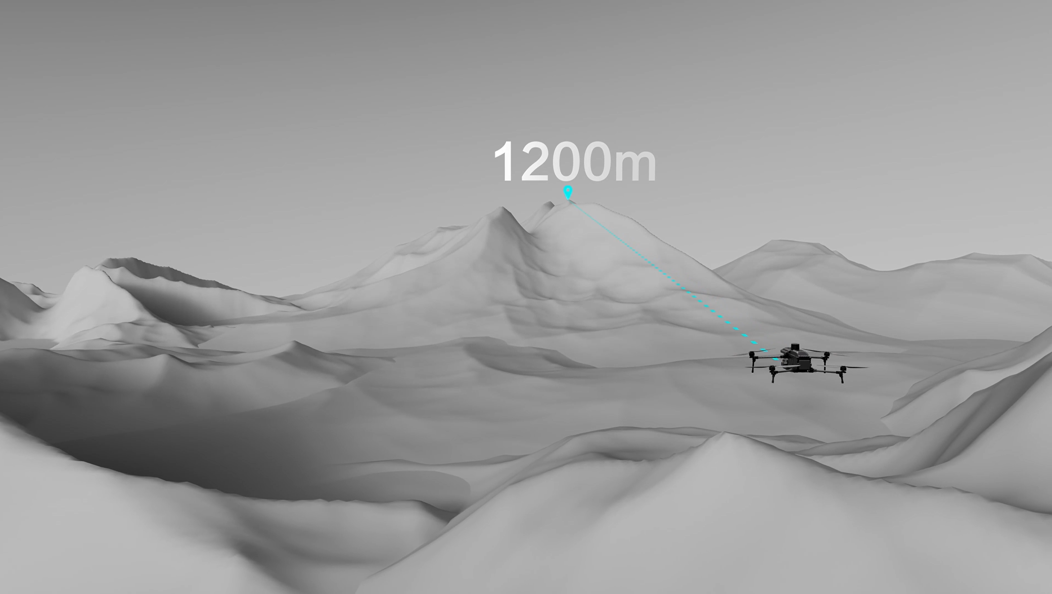
A UAV laser rangefinder can add an exact-looking distance value to a live camera view. But a value displayed to the nearest 0.1 meter is not automatically accurate to 0.1 meter, and a published 1,200-meter range does not mean every target can be measured at that distance.
For procurement teams, the useful question is not simply, “Does this payload include a laser rangefinder?” It is, “Can the complete payload obtain a valid distance to our actual target, from our working distance, while the aircraft and gimbal are operating?”
This guide explains how a drone laser rangefinder works, separates the specifications that are commonly confused, and uses the HEQ K40T quad-sensor payload as a worked example. The same evaluation method can be applied to other UAV laser rangefinder payloads.
How a UAV laser rangefinder measures distance
The most common long-range architecture is direct time of flight. A transmitter emits a short laser pulse toward the target. Part of that light reflects back into the receiver, and the electronics measure the round-trip travel time. The basic relationship is:
Distance = speed of light × round-trip time ÷ 2
The division by two matters because the pulse travels to the target and back. At 1,200 meters, the round trip takes only about 8 microseconds. Measuring such a short interval requires a fast detector, timing electronics and enough reflected energy to distinguish the return from background light and noise. Hamamatsu Photonics provides a useful technical explanation of direct time-of-flight measurement.
A compact rangefinder normally reports one distance along its line of sight. It is not automatically a scanning LiDAR, an altimeter or a survey-grade point-cloud system. If the gimbal is looking diagonally at a roof, vehicle or tower, the reported value is the slant range from the payload to the reflection point.
The sensor measures the round-trip travel time, so the optical path is twice the target distance.
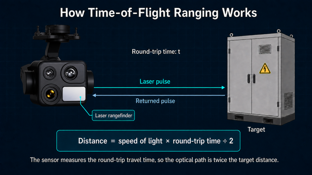
The sensor measures the round-trip travel time, so the optical path is twice the target distance.
The five rangefinder specifications buyers should separate
The current K40T specification page lists a 905 nm laser rangefinder with a 5–1,200 m measurement range, ±1 m measurement accuracy, 0.1 m distance resolution, 3.2 mrad beam divergence and 1–10 Hz measurement frequency. Each value answers a different procurement question.
| Specification | K40T published value | What it tells the buyer | What it does not prove |
|---|---|---|---|
| Measurement range | 5–1,200 m | The stated minimum and maximum measurement envelope | That every target returns a valid reading at 1,200 m |
| Measurement accuracy | ±1 m | The stated closeness of a reading to the reference distance under applicable test conditions | That the last displayed decimal is accurate |
| Distance resolution | 0.1 m | The smallest reporting increment or distinguishable distance step stated for the system | ±0.1 m absolute accuracy |
| Beam divergence | 3.2 mrad | How rapidly the laser footprint expands with distance | That the full footprint falls on the intended object |
| Measurement frequency | 1–10 Hz | How often the system can produce or update range measurements | Camera frame rate, control latency or guaranteed valid-return rate |
1. Measurement range: where a reading may be possible
Measurement range is an operating envelope, not a promise that all objects are equally measurable. Return strength depends on distance, target reflectivity, target orientation, atmospheric transmission, receiver aperture, background light and whether the beam footprint remains on the target. Dark, angled or small surfaces may produce a weaker return than a large, light-colored, front-facing surface.
The minimum range matters too. A system specified from 5 meters should not be assumed to provide valid readings inside that distance. Procurement tests should include the nearest and farthest distances that the mission actually requires rather than testing only the headline maximum.
2. Accuracy: how close the result is to the reference
Accuracy describes closeness to the true or reference distance. If a reference target is exactly 300.0 m away, a ±1 m accuracy specification describes a tolerance band around that value under the specification’s applicable conditions. It does not mean every reading will vary by one meter, and it does not describe the display increment.
For procurement, ask how accuracy was verified: target type and reflectivity, distance, lighting, weather, incidence angle, sample count and whether the test was performed from a fixed mount or a flying platform. Without the test conditions, two vendors’ accuracy figures may not be directly comparable.
3. Resolution: the size of the reported step
Distance resolution and measurement accuracy are not interchangeable. A payload can report 300.1 m, 300.2 m and 300.3 m while still having a stated absolute accuracy of ±1 m. The 0.1 m resolution makes changes and displayed values more granular; it does not turn the system into a ±0.1 m instrument.
This distinction matters when a software interface stores distance values. Extra decimal places improve reporting granularity, but they should not be presented as evidence of extra absolute certainty.
4. Beam divergence: how large the illuminated footprint becomes
A laser beam is not an infinitely thin line. Beam divergence describes its angular expansion. For a first-order estimate, ignoring the beam’s initial diameter:
Additional beam diameter ≈ divergence in milliradians × distance in meters ÷ 1,000
If the published 3.2 mrad value is a full-angle divergence, the K40T beam footprint expands by approximately:
| Slant distance | Approximate added beam diameter | Practical interpretation |
|---|---|---|
| 50 m | 0.16 m | A small footprint, but precise boresight alignment still matters |
| 200 m | 0.64 m | The beam may cover much of a cabinet, panel or vehicle surface |
| 500 m | 1.60 m | A narrow target or asset edge may no longer fill the footprint |
| 1,200 m | 3.84 m | Foreground and background surfaces can fall within the same approximate footprint |
These figures are geometric approximations, not guaranteed spot diameters. The initial beam size and whether the manufacturer reports full-angle or half-angle divergence must be confirmed. Beam divergence also should not be confused with camera field of view or thermal-camera pixel footprint.
The operational lesson is straightforward: at long distance, place the aiming reticle well inside the target rather than on an edge. If part of the beam reaches a nearer or more reflective background, the returned distance may not represent the object the operator intended to measure.
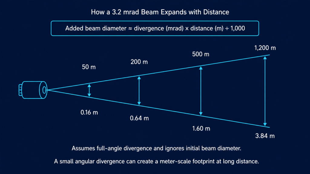
A small angular divergence can create a meter-scale footprint at long distance.
5. Measurement frequency: how quickly distance updates
A 1–10 Hz measurement frequency means up to ten range updates per second at the highest supported setting. A higher update rate can make the reading more useful while the aircraft, gimbal or target is moving. It does not improve the stated ±1 m accuracy, and it is not the same as the camera’s video frame rate.
Buyers should also ask about end-to-end behavior: whether the mode is single-shot or continuous, how invalid returns are flagged, how quickly the result reaches the operator interface, whether measurements are timestamped, and whether the distance can be recorded with images or telemetry.
Why a valid range reading can still miss the intended target
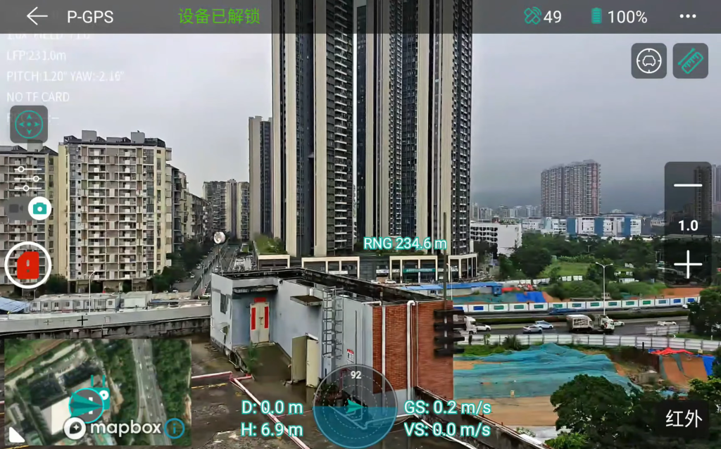
The rangefinder measures the surface that returns usable laser energy, while the operator aims using a camera image. Those two optical paths must be aligned. Small boresight error, gimbal motion, vibration, latency or reticle calibration error can shift the laser footprint away from the visual point of interest—especially at long range.
- Target reflectivity: Some surfaces return more energy than others.
- Incidence angle: An oblique surface can direct less energy back toward the receiver.
- Atmosphere: Haze, rain, dust and other particles can attenuate or scatter the signal.
- Background light: Strong illumination adds noise at the receiver.
- Target size versus beam footprint: The intended surface may occupy only part of the illuminated area.
- Platform motion and alignment: The beam and camera reticle must remain correctly registered during measurement.
Hamamatsu’s photonics guide to time-of-flight LiDAR explains how returned power decreases with distance and depends on target reflectivity, receiver optics, atmospheric extinction and background photons. Although a single-point UAV rangefinder is not the same product as automotive scanning LiDAR, these optical constraints remain relevant.
A practical UAV ranging workflow
- Use the wide-angle camera to locate the asset and preserve scene context.
- Use the telephoto camera to confirm the intended measurement surface and place the reticle away from edges.
- Stabilize the gimbal and obtain a single or continuous range reading as required.
- Check whether the reading is stable and plausible relative to the scene.
- Record the image, time, aircraft position, gimbal orientation and range value if the workflow requires traceability.
- Reposition or repeat the measurement when the target is small, oblique, partly hidden or backed by another surface.
This is where a multi-sensor payload can be more useful than a rangefinder considered in isolation. The K40T combines wide-angle imaging, zoom telephoto imaging, thermal imaging and laser ranging. The cameras help the operator locate and confirm the surface; the rangefinder adds slant distance. Our earlier guide explains the broader wide-angle, telephoto and thermal inspection workflow.
What ranging adds—and what it does not
| Ranging can support | Ranging alone does not provide |
|---|---|
| Slant distance to the measured reflection point | Automatic target identity |
| More consistent stand-off-distance reporting | Survey-grade coordinates |
| Distance context for inspection and patrol observations | A dense 3D point cloud |
| A measurement input for a larger geolocation workflow | Horizontal distance or altitude unless geometry is calculated |
Turning a slant range into a geographic target coordinate requires more than the rangefinder. The system also needs accurately synchronized aircraft position, aircraft attitude, gimbal angles, sensor boresight calibration and an appropriate earth or terrain model. Ask whether the supplier’s integration exposes the required metadata and how the complete geolocation chain is calibrated and tested.
How to test a laser rangefinder payload before procurement
A useful acceptance test should resemble the intended mission. The original content brief calls for tests at 50, 200 and 500 meters; add other distances if they represent your real operating envelope.
- Establish reference distances with a suitable independent method.
- Select targets representative of the real assets, including different sizes, colors, finishes and orientations.
- Test both static mounting and normal hover conditions.
- At each distance, record repeated readings rather than one successful sample.
- Calculate error relative to the reference, reading-to-reading spread and valid-return rate.
- Repeat under representative daylight and weather conditions within the approved operating limits.
- Check reticle-to-laser alignment near the center and edges of the operational zoom range.
- Verify how invalid measurements, latency, timestamps, units and stored metadata appear in the control software.
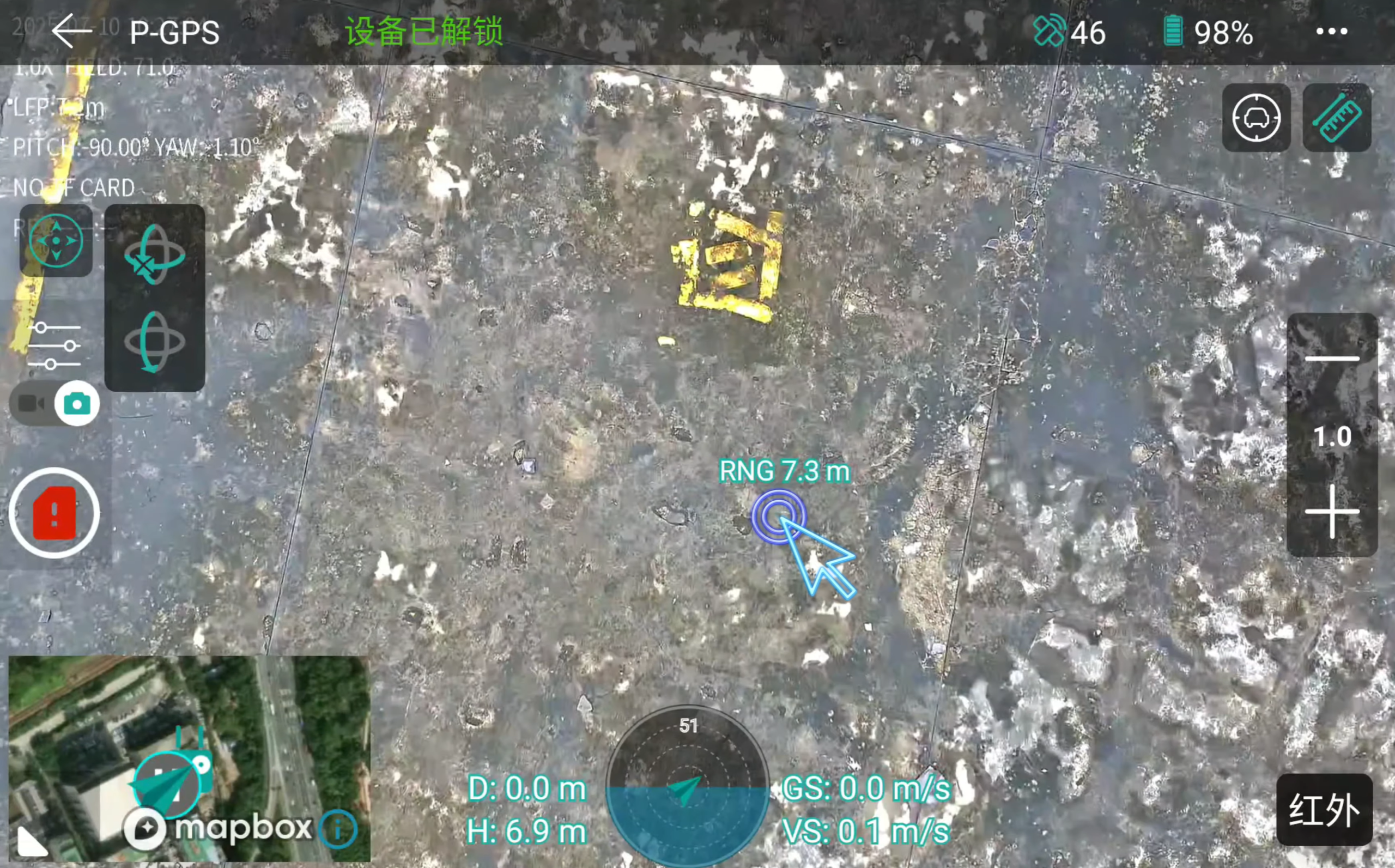
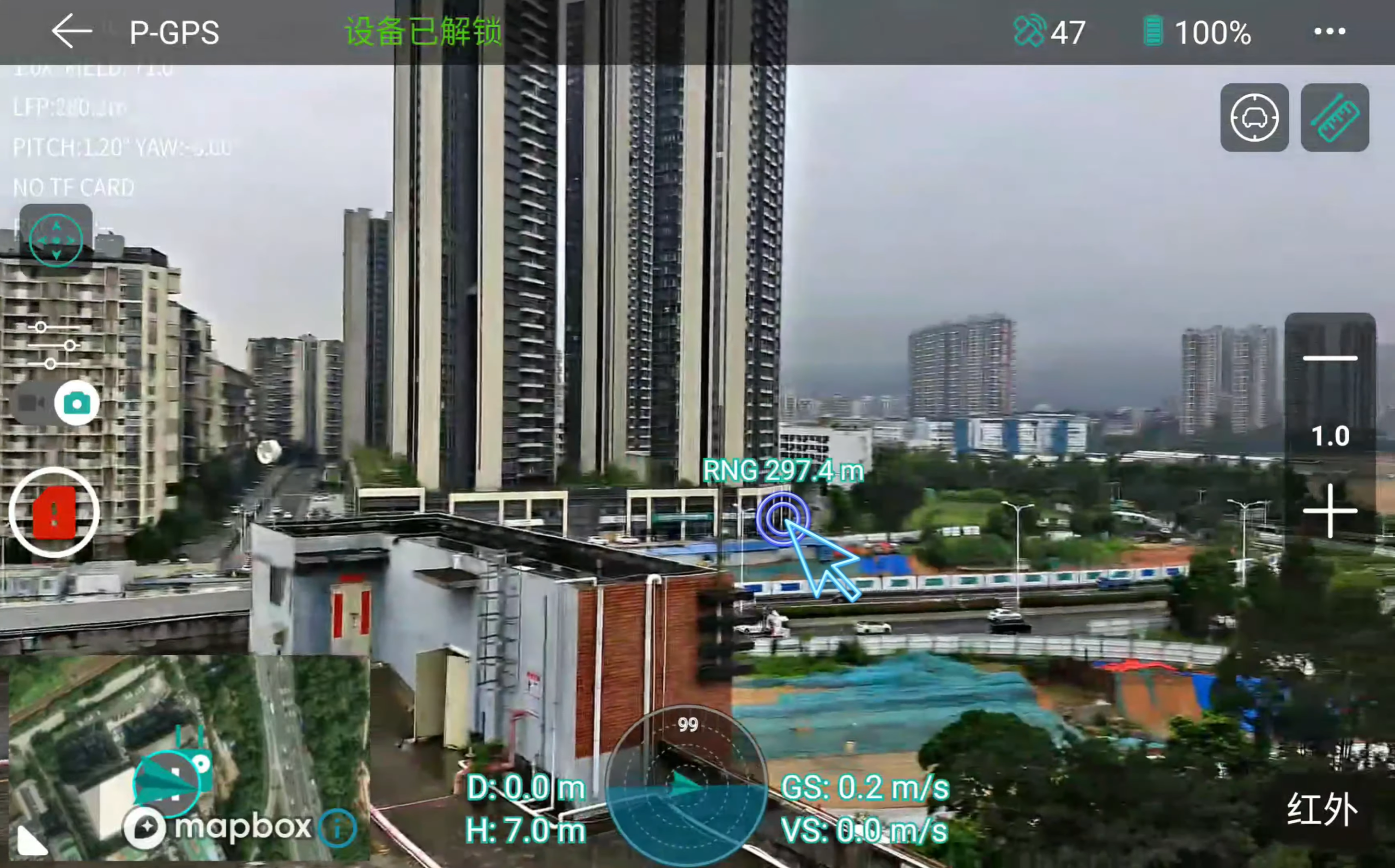
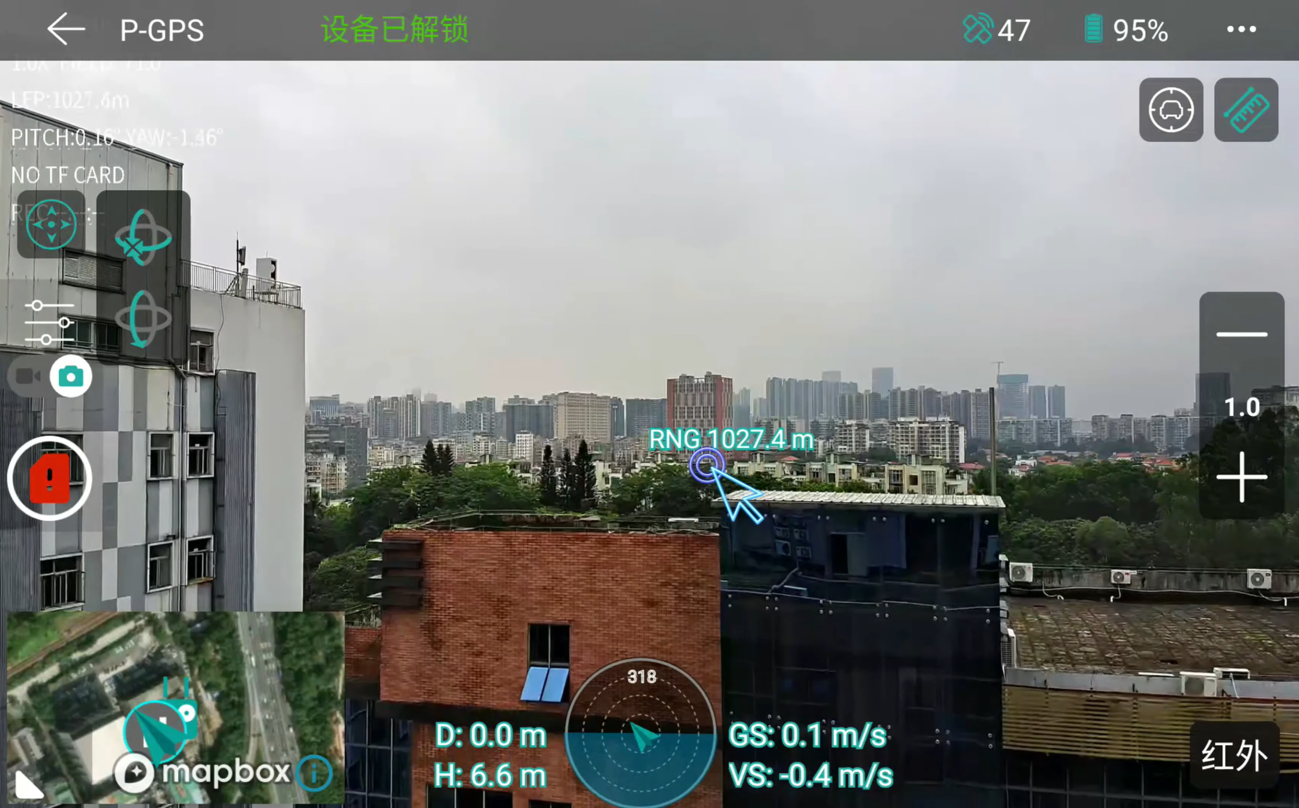
Compare repeated measurements under documented conditions, not one successful maximum-range reading.
Laser safety and documentation belong in the specification review
Wavelength alone does not establish that a laser product is safe for a particular use. The K40T page lists 905 nm, which is near-infrared and outside normal human visibility, but buyers should request the product’s laser classification, labeling, instructions and applicable compliance documentation. Do not describe a rangefinder as “eye-safe” unless the supplied classification and operating conditions support that claim.
For European procurement, IEC 60825-1 addresses laser-product classification and requirements. For the United States, the FDA explains laser product classifications, labeling and federal performance requirements. The exact obligations depend on the final product, market and use case, so the purchaser’s compliance team should review the supplied documentation.
Laser rangefinder procurement checklist
- What target and atmospheric conditions support the stated minimum and maximum range?
- How were accuracy and resolution defined and tested?
- Is beam divergence specified as full angle or half angle, and what is the initial beam diameter?
- What happens when the footprint includes more than one surface?
- Which measurement rates are available, and are they selectable in the supplied software?
- How are invalid, weak or out-of-range returns reported?
- How is the laser aligned with the visible-camera reticle across zoom and distance?
- Can range values be timestamped and stored with images or telemetry?
- What protocol commands and data fields are available for integration?
- What laser classification, labels and market-specific compliance documents are supplied?
The practical takeaway
A strong UAV laser rangefinder specification is not one large range number. It is a coherent set of values: operating range, accuracy, resolution, beam divergence and update frequency, supported by clearly documented test conditions and integration behavior.
For the K40T, the published 5–1,200 m range, ±1 m accuracy, 0.1 m resolution, 3.2 mrad divergence and 1–10 Hz measurement frequency should be evaluated together. The rangefinder becomes most useful when the operator can confirm the intended surface with the camera system, obtain a stable return and preserve enough metadata for the downstream workflow.
Discuss Your UAV Ranging Requirements
Frequently asked questions
Is laser rangefinder resolution the same as accuracy?
No. Resolution describes the smallest reported or distinguishable distance step. Accuracy describes closeness to the reference distance. A system with 0.1 m resolution and ±1 m accuracy can display tenths of a meter without being accurate to one tenth of a meter.
Does a 1,200 m range mean every target can be measured at 1,200 m?
No. Maximum range depends on the applicable test conditions and target. Surface reflectivity, angle, beam footprint, atmosphere, background light, alignment and platform motion can all affect whether the receiver obtains a valid return.
How large is a 3.2 mrad laser beam at 500 m?
Using a first-order calculation and treating 3.2 mrad as full-angle divergence, the beam adds approximately 1.6 m of diameter at 500 m, before including its initial diameter. Confirm the manufacturer’s divergence convention for an exact interpretation.
Can a UAV laser rangefinder provide target coordinates?
The rangefinder supplies slant distance to a reflection point. Calculating geographic coordinates also requires synchronized aircraft position and attitude, gimbal angles, boresight calibration and an appropriate coordinate and terrain model.